

North Fork Wetlands Bank
Prince William County, Virginia
Owner: Boy Scouts of America
This 125-acre project, conceived and developed by Wetland Studies and Solutions, Inc. (WSSI), was the second private wetlands bank approved in northern Virginia - Julie J. Metz Wetlands Bank, also conceived and designed by WSSI, was the first - and the first mitigation bank approved to sell stream credits in Virginia. Construction began in June 1998 and was completed in July 2000. The project’s innovative design elements provide wetlands with high functions and values that can be used by developers and governmental agencies to offset unavoidable wetland impacts from other, smaller projects. The 125 acres consist of approximately 80 acres of constructed wetlands and waters with the remainder of the site being reforested upland buffers. The site was donated to the Boy Scouts of America upon its completion and has been incorporated into the Boy Scout’s Camp Snyder, offering nature trails, board walks, and interpretative facilities for environmental education programs.
North Fork’s unique design features include:
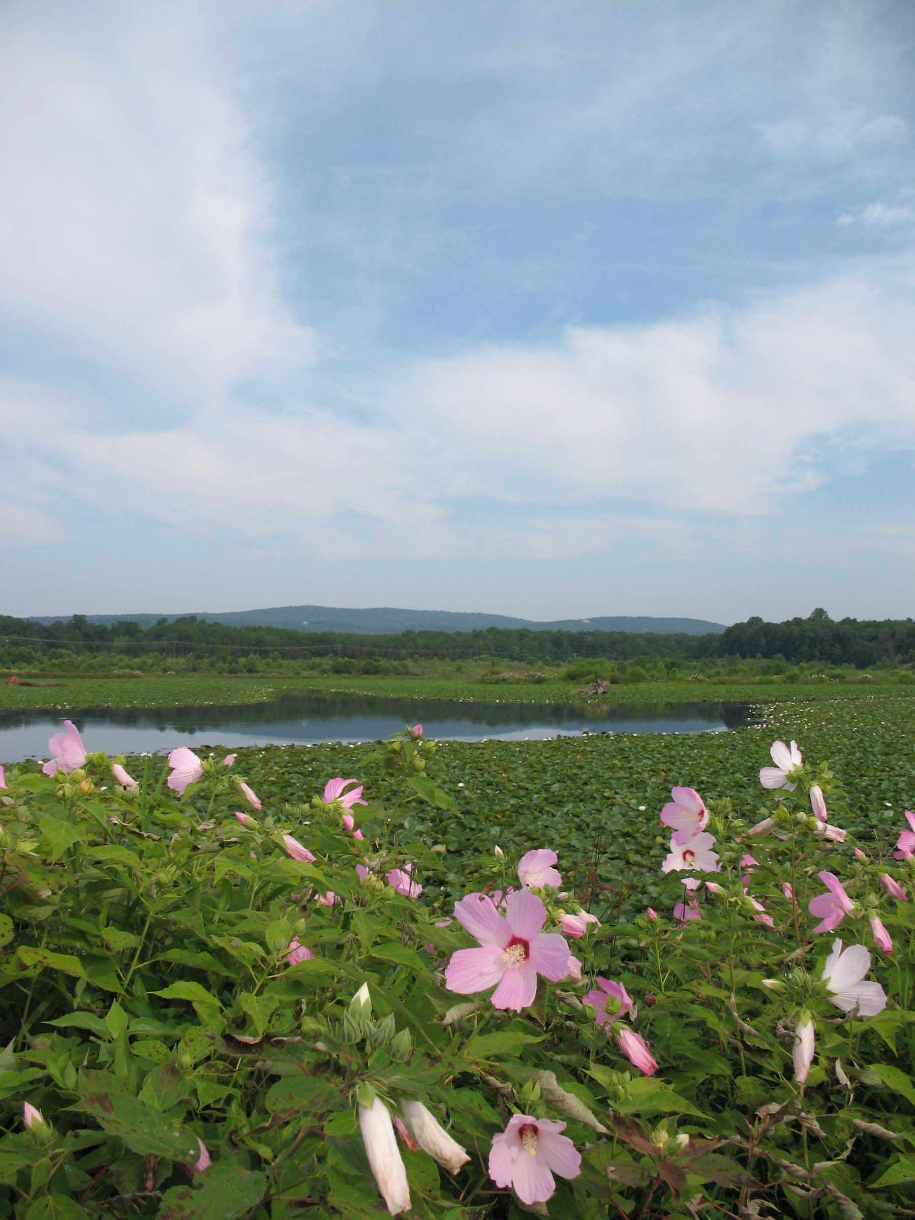
An impounded area consisting of 45 acres of wetlands (formed by a 1,600 linear feet long, 25 feet tall dam designed for the Probable Maximum Flood (P.M.F.) event with 2 feet of free board in an +800 acre watershed);
Numerous vernal pools (made by creating low areas and lining them with clay) to serve as resting spots for migrating birds and refuges and reproducing areas for amphibians;
A 7-acre open water area providing canoeing opportunities for the Boy Scouts; and
Extensive areas that provide a progression of high quality habitat for submerged aquatic vegetation, floating aquatics, emergent, scrub shrub, and forested wetlands, and buffered reforestation areas.
Also see our .pdf presentation on this project.
WSSI provided the following services for the North Fork Wetlands Bank:
Mitigation Banking Instrument
Mitigation Credit Accounting Ledger
COE Nationwide Permit
Vegetation and hydrology monitoring reports
Soil permeability and fertility testing
Photo documentation
Dam inspections
WOUS delineation
Jurisdictional Determination
Archeology Phase I report
ETS research
Wetland mitigation concept plan
Wetland design/construction plan set
As-built survey