

contact us to discuss your project
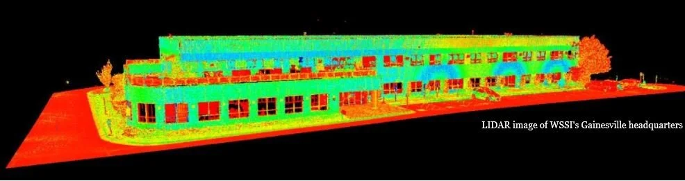
WSSI provides Reality Capture, Laser Scanning, and Unmanned Aerial Vehicle (UAV or drone) services to support site and right-of-way studies, project design, and construction phase processes. We use this state-of-the-art technology to measure, inspect, and monitor project sites – bringing new opportunities to streamline assessment and monitoring tasks. This technology also facilitates sharing this data with potential investors and stakeholders.
UAV alone is a powerful tool. Drone photogrammetry and high-definition 3D laser scanning are efficient, cost-effective, and can readily access difficult locations and cover expansive sites. It can be easily repeated over time to monitor changes in the landscape. Reality Capture creates 3D data sets by combining the drone photogrammetry with aerial LiDAR and 3D laser scanning.
UAV, Laser Scanning, and Reality Capture are excellent tools for all who work with the land:
- Residential and commercial developers
- Energy companies
- Engineers
- Surveyors
- Real estate agents
- Transportation and utility agencies & companies
- Land managers
- Public safety agencies
UAV/Drone, Laser Scanning, and Reality Capture provide


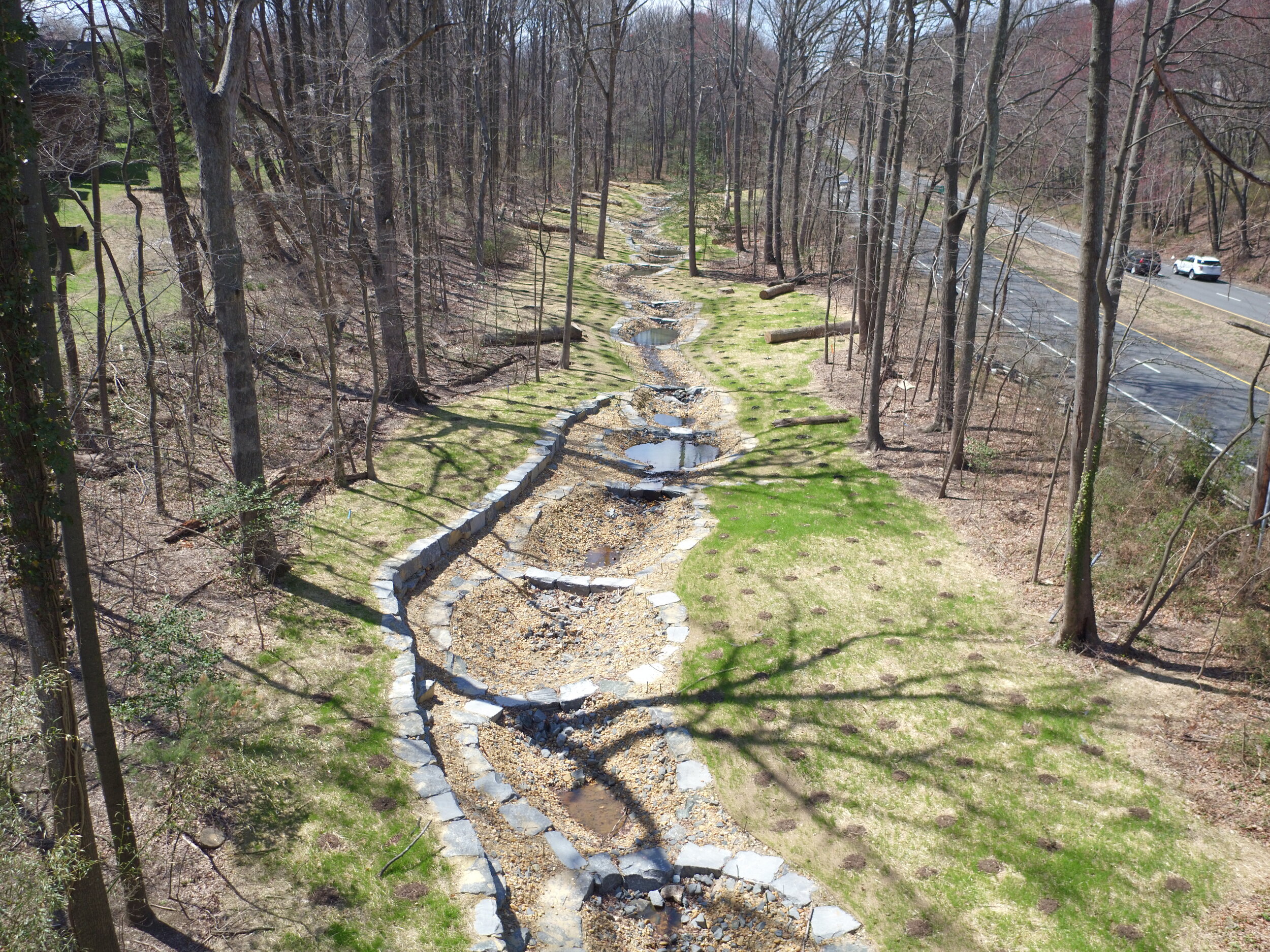


Easily maneuverable and small, drones can access multiple perspectives (above the canopy, from a right of way), and can reach areas not visible from standard up-in-the-air flightlines and difficult to access from the ground.
Highly detailed drone photogrammetry is an efficient way to record corridor encroachments and vegetation types and densities, making maintenance planning easy. Drones can be deployed to the exact same locations time after time, to evaluate maintenance success and to plan for the future.
Through WSSI's Reality Capture technologies, large data sets can be easily shared and accessed by clients in the office or in the field - even on a smart phone.

WSSI staff using a Leica High-Definition Laser Scanner
Reality Capture, Laser Scanning and UAV/Drone Service uses include:
Photography and Videography
Real estate marketing
Panoramic images
3D models for virtual tours
Inspections and monitoring: construction, encroachments, site maintenance
Survey-grade detail
Real-time inspections to track project progress
Cut/Fill analysis on construction sites and quarries
Topography, floodplain evaluation, 3D modeling of existing conditions and as-builts (allows for virtual design)
Land surveying (as-builts, topographic)
Bathymetric surveys
Wildlife surveys (such as nest counts and habitat analysis)
Aerial tree health inspections
Vegetation analysis
Dam removal monitoring
Virtual spatial/collision analysis
LiDAR & Photogrammetry Support, Training, and Consultation via CivilTraining
UAV flight and post processing
UAV program development (Regulation/Safety/Best Practices)
HD Scanning (Terrestrial LiDAR) Program Development and Processing
Point Cloud Registration and Post-Processing
Point Cloud-Developed Planimetric and Topographic Mapping
LiDAR Data Analysis, Manipulation, Registration, and Optimization